
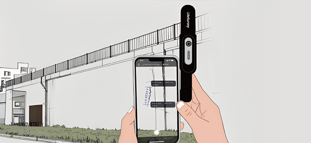
相中之形,按图索骥
LiteSurvey 2 搭载了我们创新的像素级地理标签技术。这项技术借助于iPhone Pro上的激光雷达与相机,捕捉附有完整深度信息的真实场景。照片中的每个像素都将被赋予精确的GNSS坐标。无论是绘制复杂地物,还是计算面积,您都将拥有前所未有的细节与效率。

点到即走,无需对中
利用LiteSurvey 2 Pro先进的倾斜补偿功能,您的外业效率将极大提升。您无需再为精确对中气泡而耗费时间。只需将杆尖触及测量点,即可瞬时完成记录。面对墙基、屋角等障碍点,测量从此变得轻松准确。

激光所至,测量无“距”
面对难以触及之点,LiteSurvey 2 Pro的激光功能是您的理想之选。您只需瞄准附近的任何目标,无论是沟槽中的管线点,还是天花板上的螺栓,即可在原地即时捕获其厘米级精度的坐标。
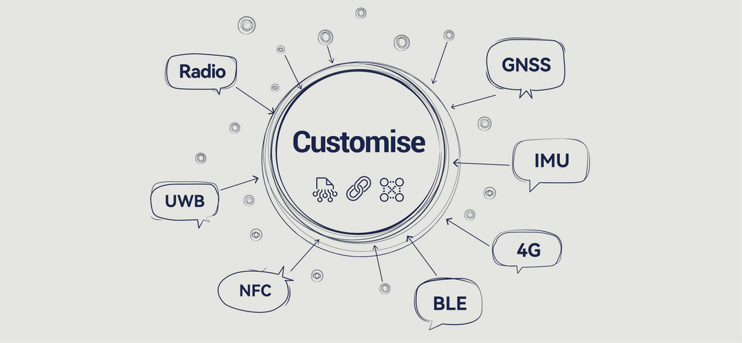
北斗定位,为您量身定做
桓参科技不仅提供标准产品,我们更是一支经验丰富的GNSS工程师与设计师团队。我们专注于打造定制化的硬件、专用固件和软件应用。如果您有特定的工作流程或独特的集成需求,我们愿与您携手,为您量身打造完美的GNSS解决方案。
LiteSurvey Pro: 为专业测绘量身定做的App
Uncompromising Geodetic Integrity
At the core of our app is a robust geodetic engine. We provide reliable, high-precision coordinate transformations from raw GNSS data (BLH) to any local grid (NEU). With native support for nearly the entire EPSG database, you can work confidently in any coordinate system, anywhere in the world.


Coming Soon: Cloud Sync & Team Collaboration
Transition from a single-user tool to an enterprise platform. Our upcoming cloud service will offer real-time project syncing for teams. Project managers will be able to assign granular access levels (view, edit, admin) to team members, ensuring data integrity and streamlining field-to-office workflows.
A Modern UI That Works With You, Not Against You
Transition from a single-user tool to an enterprise platform. Our upcoming cloud service will offer real-time project syncing for teams. Project managers will be able to assign granular access levels (view, edit, admin) to team members, ensuring data integrity and streamlining field-to-office workflows.

The Right Engine for Your Workflow
Start with the real-world context of the Google Maps engine. Seamlessly switch to our upcoming native CAD engine for design-centric tasks with vector snapping and complex layer handling. For enterprise users, our future ArcGIS engine support will provide direct integration with your organization's GIS data and services.
Download LiteSurvey Pro

