
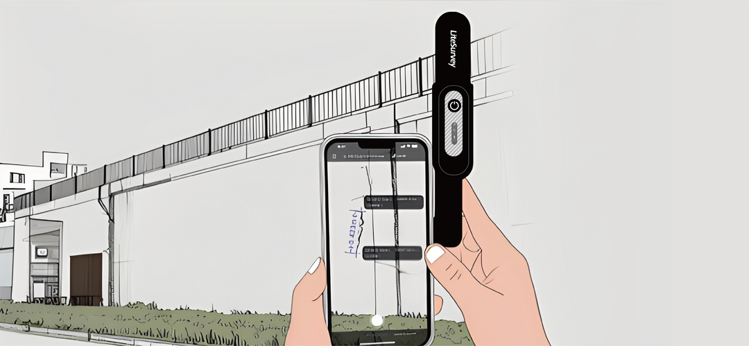
Geo-tagged pixels: map every detail
Move beyond single-point surveying. Our innovative Geo-tagged Pixel technology, powered by the LiteSurvey 2, uses the camera on your LiDAR-equipped iPhone to capture a complete, depth-aware scene. Every pixel in the photo is assigned precise GNSS coordinates, enabling you to map complex features, calculate areas, or document site conditions with unprecedented detail and efficiency.

Touch and Go. No Leveling Needed
Speed up your fieldwork with the LiteSurvey 2 Pro's advanced tilt compensation. There’s no need to waste time meticulously leveling the bubble. Simply place the tip of the survey pole on the measurement point and record. It’s perfect for capturing the base of walls, building corners, and other obstructed points quickly and accurately.

Laser reached, measurement done
When a point is difficult to reach, the LiteSurvey 2 Pro's integrated laser provides the solution. Simply aim at any target near you — a utility point in a trench, a bolt on a ceiling, or a nearby structural element — and instantly capture its centimeter-accurate coordinates without leaving your position.
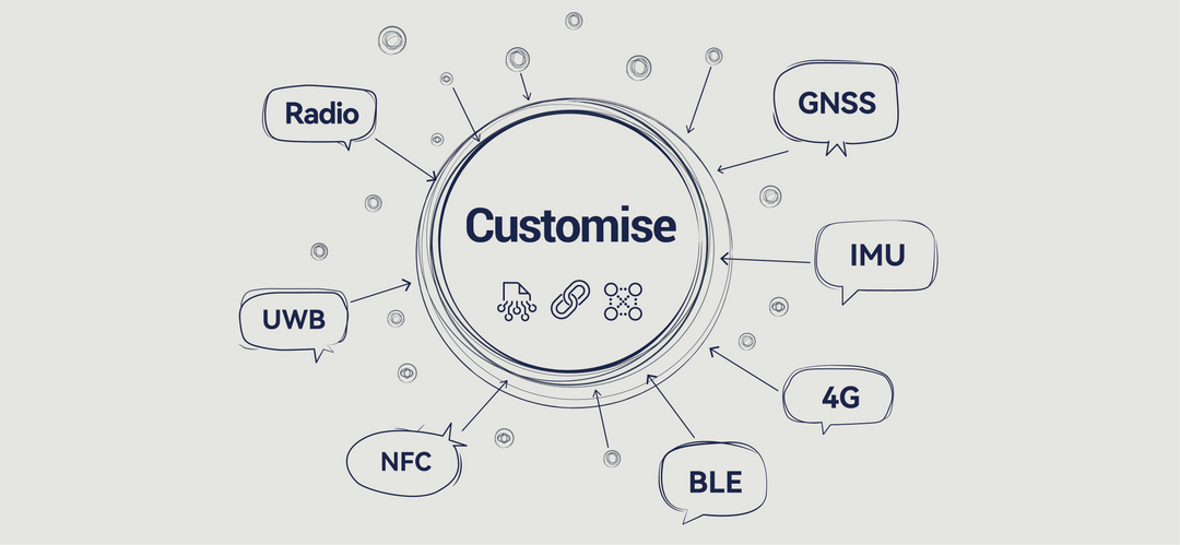
Have a Unique Challenge? Let's Build Your Solution
Beyond our standard products, Woncan LiteSurvey is a team of experienced GNSS engineers and designers. We specialize in creating custom hardware form factors, specialized firmware, and tailored software applications. If you have a specific workflow or a unique integration need, we can partner with you to develop a GNSS solution that is designed exactly for you.
LiteSurvey Pro: Tailor-Made App for Professional Geomatics
Uncompromising Geodetic Integrity
At the core of our app is a robust geodetic engine. We provide reliable, high-precision coordinate transformations from raw GNSS data (BLH) to any local grid (NEU). With native support for nearly the entire EPSG database, you can work confidently in any coordinate system, anywhere in the world.


Coming Soon: Cloud Sync & Team Collaboration
Transition from a single-user tool to an enterprise platform. Our upcoming cloud service will offer real-time project syncing for teams. Project managers will be able to assign granular access levels (view, edit, admin) to team members, ensuring data integrity and streamlining field-to-office workflows.
A Modern UI That Works With You, Not Against You
Transition from a single-user tool to an enterprise platform. Our upcoming cloud service will offer real-time project syncing for teams. Project managers will be able to assign granular access levels (view, edit, admin) to team members, ensuring data integrity and streamlining field-to-office workflows.

The Right Engine for Your Workflow
Start with the real-world context of the Google Maps engine. Seamlessly switch to our upcoming native CAD engine for design-centric tasks with vector snapping and complex layer handling. For enterprise users, our future ArcGIS engine support will provide direct integration with your organization's GIS data and services.
Download LiteSurvey Pro

